


Good Hope Church, Dallas County, Alabama
About
Outline

Summary
| Unique Area Identifier | 521653 |
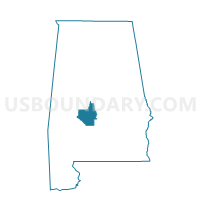
| Name | Good Hope Church |
| County | Dallas County |
| State | Alabama |
| Area (square miles) | 43.88 |
| Land Area (square miles) | 43.76 |
| Water Area (square miles) | 0.12 |
| % of Land Area | 99.73 |
| % of Water Area | 0.27 |
| Latitude of the Internal Point | 32.17558820 |
| Longtitude of the Internal Point | -86.95587030 |
Maps


Graphs
Select a template below for downloading or customizing gragh for Good Hope Church, Dallas County, Alabama


Neighbors
Neighoring Voting District (by Name) Neighboring Voting District on the Map
- Carlowville Minter VFD, Dallas County, AL
- New Salem Church Voting District, Lowndes County, AL
- Old Bethel Church Voting District, Lowndes County, AL
- Shiloh School, Voc Ag Bldg, Dallas County, AL
Top 10 Neighboring County Subdivision (by Population) Neighboring County Subdivision on the Map
- Benton-Collirene CCD, Lowndes County, AL (2,027)
- Mosses CCD, Lowndes County, AL (1,861)
- Sardis CCD, Dallas County, AL (1,345)
- Carlowville CCD, Dallas County, AL (717)
Top 10 Neighboring Unified School District (by Population) Neighboring Unified School District on the Map
Top 10 Neighboring State Legislative District Lower Chamber (by Population) Neighboring State Legislative District Lower Chamber on the Map
Top 10 Neighboring State Legislative District Upper Chamber (by Population) Neighboring State Legislative District Upper Chamber on the Map
Top 10 Neighboring 111th Congressional District (by Population) Neighboring 111th Congressional District on the Map
Top 10 Neighboring Census Tract (by Population) Neighboring Census Tract on the Map
- Census Tract 7810, Lowndes County, AL (2,932)
- Census Tract 7811, Lowndes County, AL (1,861)
- Census Tract 9571, Dallas County, AL (1,345)
- Census Tract 9570, Dallas County, AL (1,274)